
The Okefenokee National Wildlife Refuge covers almost 630 square miles. Compare that to the city of Atlanta which covers 134 square miles. Or think of the Okefenokee being double the size of New York City, which spreads an impressive 300 square miles. But unlike Atlanta or New York with over 6,000 miles of roadways, the Okefenokee has only 120 miles of maintained canoe trails, which leaves the vast majority of the Swamp unmarked. Therefore, it could be quite easy to get lost if one paddles away from the marked trails.
This is why the Falcon Guidebook Paddling the Okefenokee exclaims, “Stay on the trails. Once off trail, there are surprisingly few prominent landmarks from which to regain your bearings in the Okefenokee. Some sections in the Okefenokee are obstructed by overhanging branches, downed trees, submerged stumps and logs, masses of floating Pete, aquatic vegetation, narrow banks, shallow water, or other obstacles.”
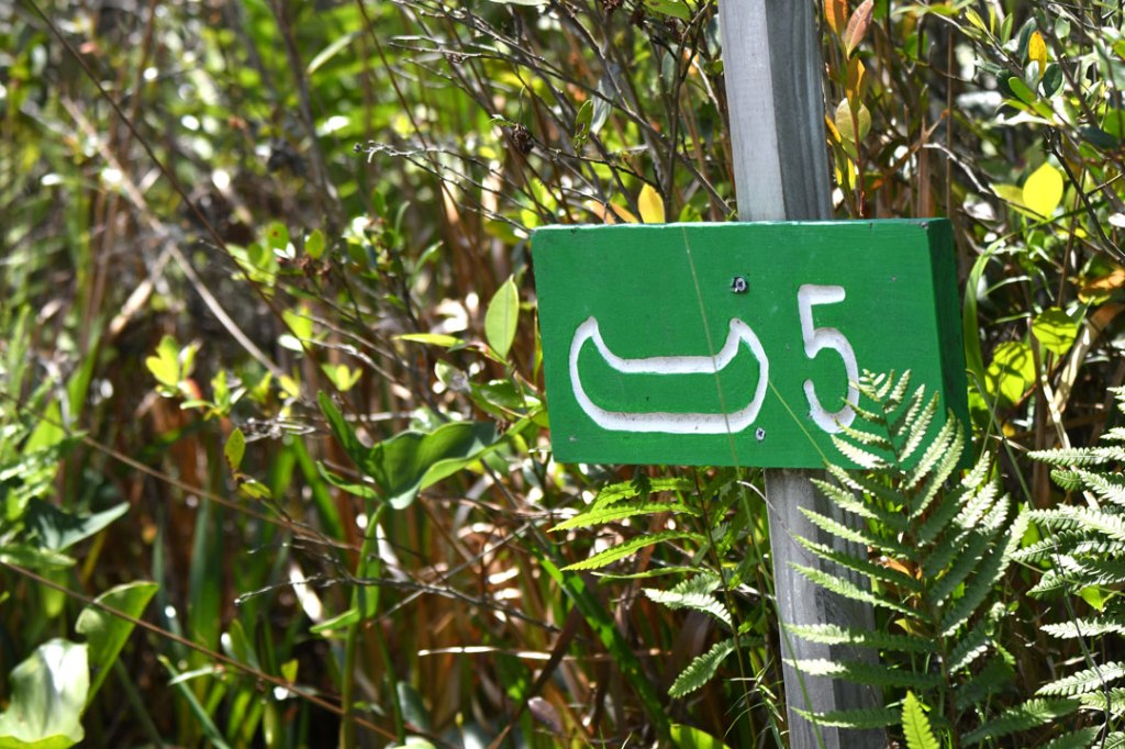
The designated trails have colored mile markers along the routes. But even with a GPS, I have occasionally found myself doubting my location while paddling the prairies. A mile marker sign may missing, damaged, or in high water, submerged! However, the US Fish and Wildlife Service does an excellent job of keeping the canoe runs obvious and open. But even so, stay on the path!

Hi William.
Thank you for such an informative and interesting post.
As a hiker who likes to follow designated routes, what they’ve done in the Swamp is great.
And, the advice to stay on marked “trails” for for both paddling and hiking.
God Bless!
LikeLiked by 1 person
Correct for above:”And the advice to stay o marked “trails” for both paddling and hiking is important!”
LikeLiked by 1 person